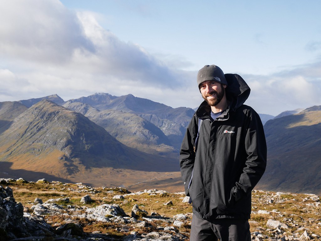
I couldn’t believe the luck we were getting with the weather in Glen Coe, we were supposed to have a relax day after hiking the challenging Aonach Eagach ridge yesterday but the weather was too good so we made an impromptu decision to hike up the popular Buachaille Etive Mor.
BUACHAILLE ETIVE MOR | 13km, 7 hours, 1110m
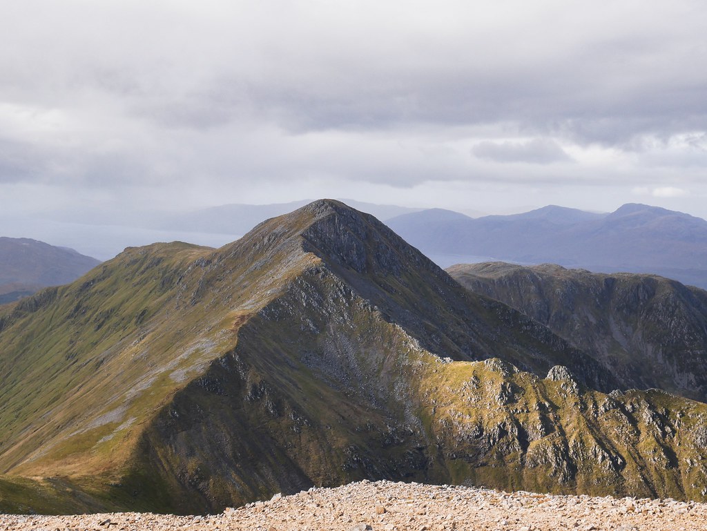
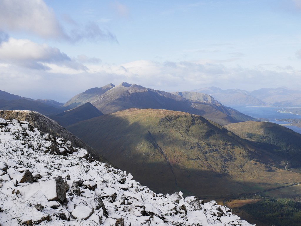
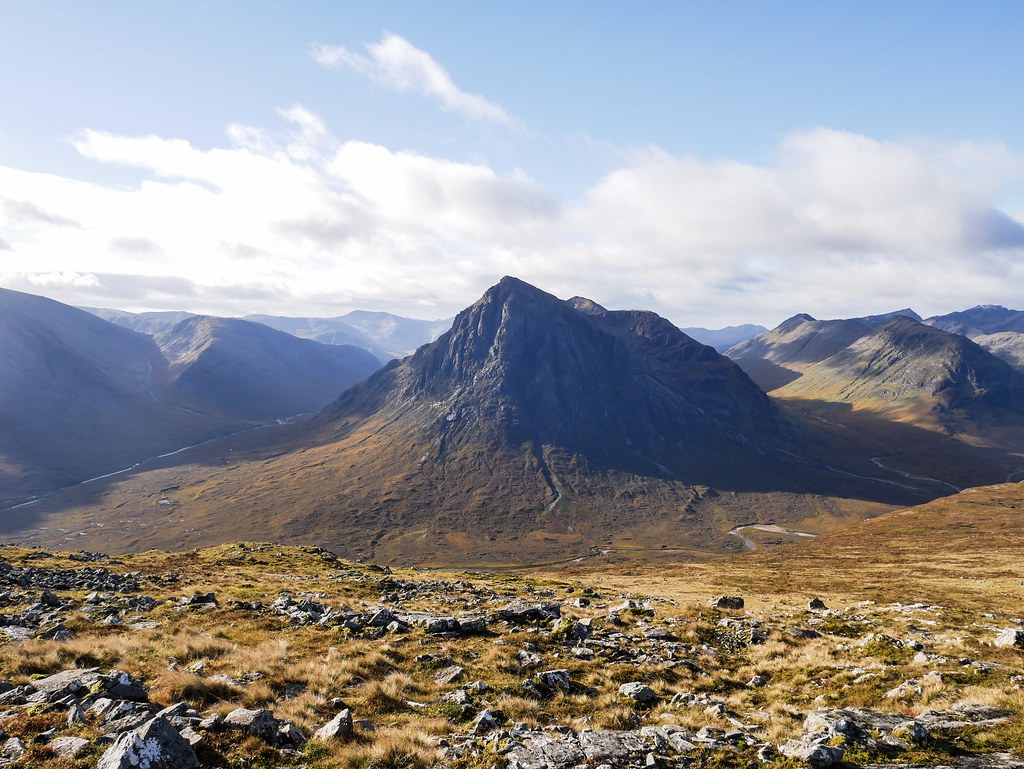
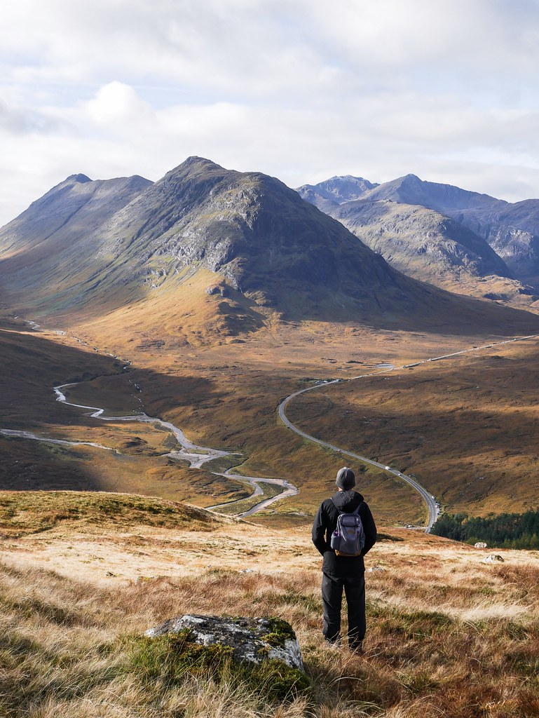
The mountain is one of the most photographed in Scotland and it almost acts like a dramatic entranceway into the Glen Coe valley, dominating the view with it’s pyramid shape. There was a good track up the mountain as it’s a pretty popular route, especially on weekends. Just before we reached the ridge we passed a group of lads who were smoking and it smelt so disgusting. I haven’t smelt cigarette smoke in almost a year and I despise the smell, especially in a natural environment like this. So I said to the lads ‘that’s not a smell I expected while hiking’ and one of them responded ‘yeah, I didn’t expect to shit myself’ which made us all laugh.

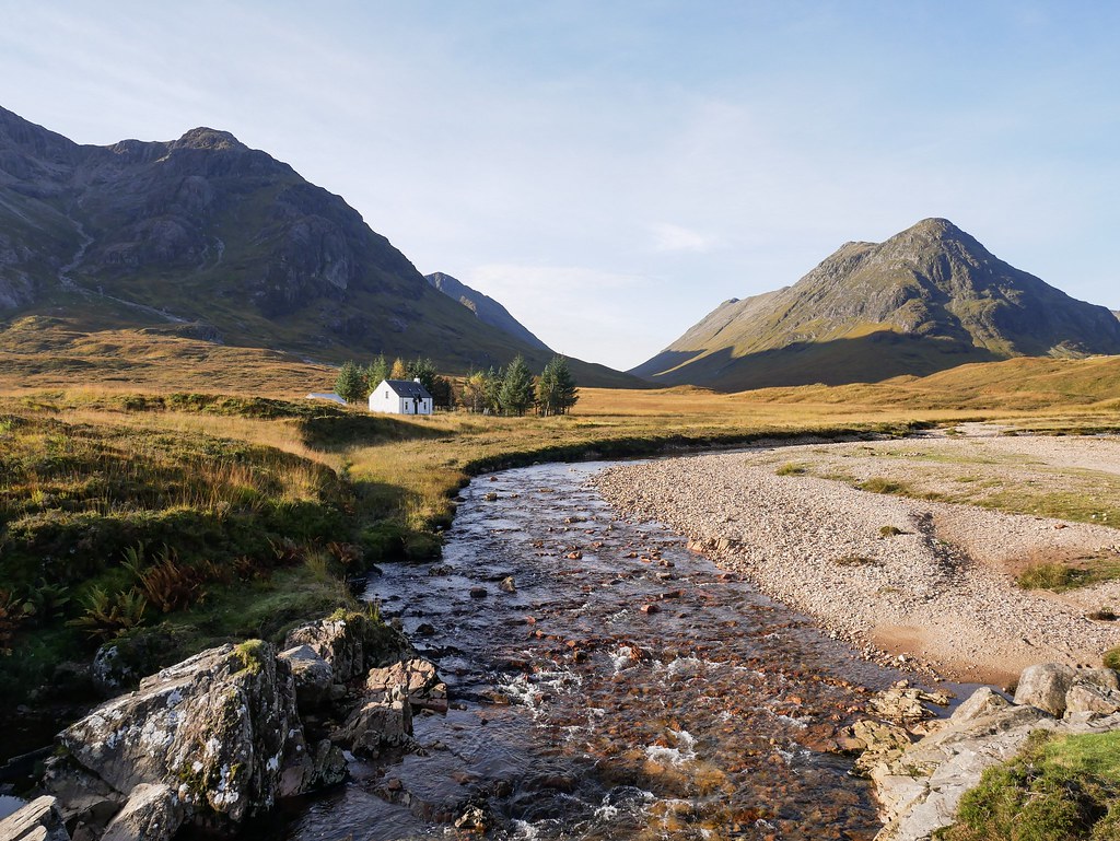
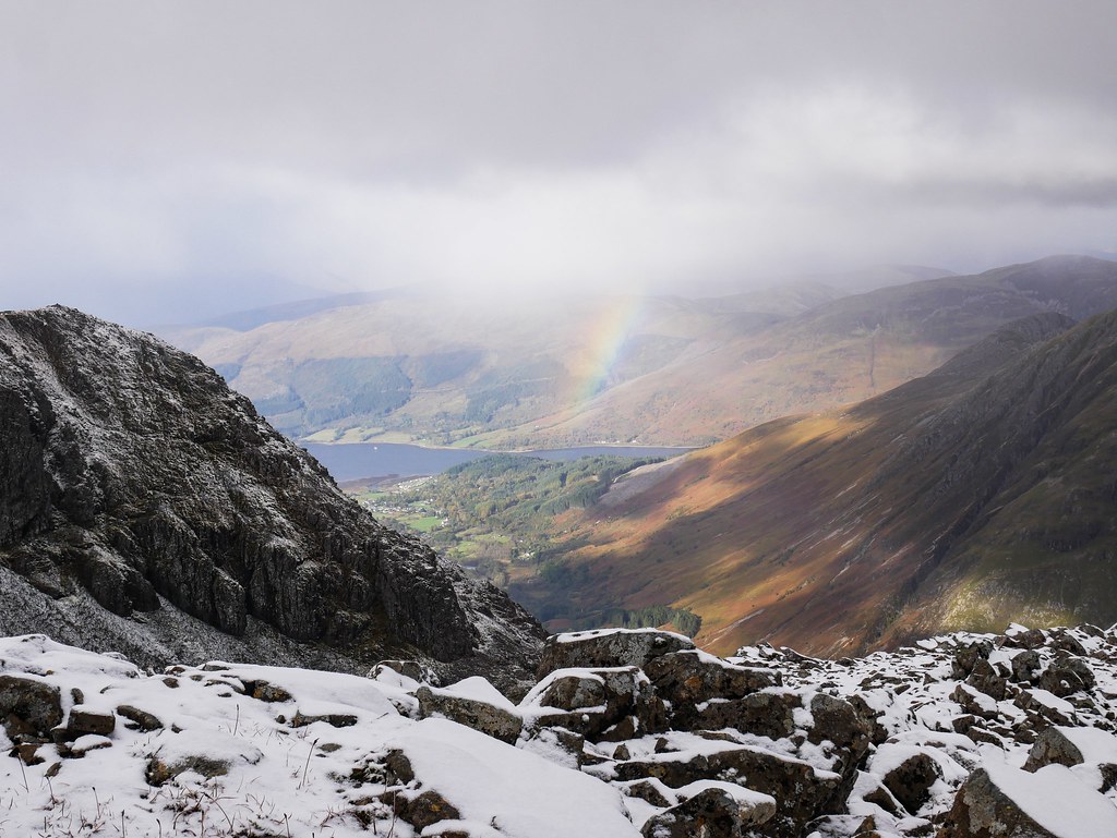
Just as we reached the ridge the sun dipped behind clouds. For Scottish weather though it was still a great day to be up on mountain. The route led us along the ridge to a couple of mountain summits. It was a very pretty hike, with deep valleys on either side of us and mountains as far as the eye could see. On our way back we walked alongside a crystal clear river, the clarity was incredible but there was no chance we were going for a swim now that the weathers much cooler. We could hear a lot of bugling stags around the valley and we actually managed to spot a few of them. One was corralling his female herd and getting rather aggressive with them if they didn’t do as he demanded. We also got to witness a smaller stag being chased down the hillside by a big male.


GLEN ETIVE SCENIC DRIVE
The following day we took it easy and did a scenic drive through the very beautiful Glen Etive. A single track road led through the valley where low cloud was clinging to the autumnal hills, there weren’t many places to park up and enjoy the view but we did find an extra long passing place to stop and enjoy lunch with a view. We didn’t have much energy so we just did a short uphill walk through bog to get a different view of the Buachaille mountains, rising like pyramids.


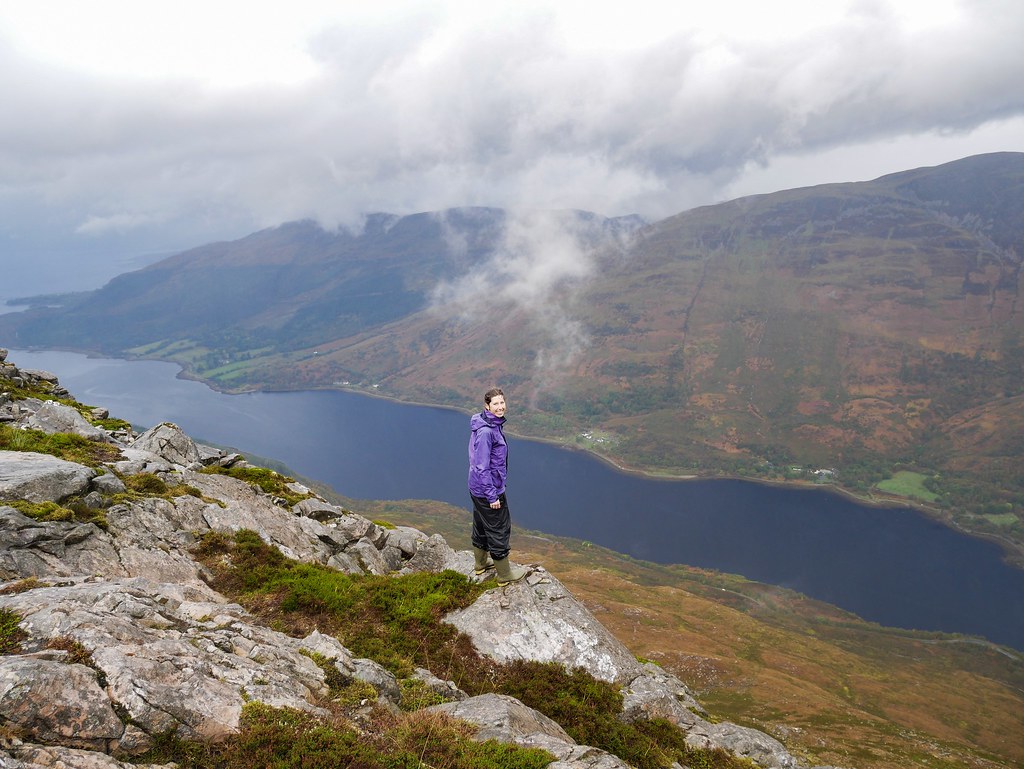
PAP OF GLENCOE | 7km, 3 hours, 716m
The weather turned a bit nasty the next two days, we attempted a hike up the Pap of Glencoe which is just a short hike when compared to others in the valley. It was about 700m elevation gain but we were up and down in just 3 hours. The weather was miserable with drizzly rain the entire time so we barely got any views but the loch below us made a brief appearance. As we were about a kilometer from the car park a group of 6 people were heading up and asked how much further there was to reach the top and I practically snorted. I couldn’t help myself and turned back to see the summit way in the distance and just said “you’ve only just started…” Surely everyone reads a little hike description first and has an idea of what’s to come, how long the hike should take etc as this one is supposed to take between 3 and 5 hours and they’d been hiking for just 30 minutes.
BEINN A’ BHEITHIR VIA SCHOOLHOUSE RIDGE | 15.5km, 8 hours, 1387m
After that rainy mess we didn’t dare hike the next day, so it gave us a good chance for our legs to recover before we were back in the mountains. This time we were heading up Beinn a’ Bheithir via schoolhouse ridge. It’s not really in the main Glen Coe valley as it’s right at the tail end which means it’s barely noticed by tourists.

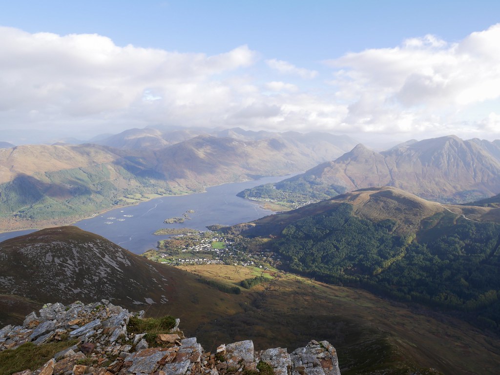
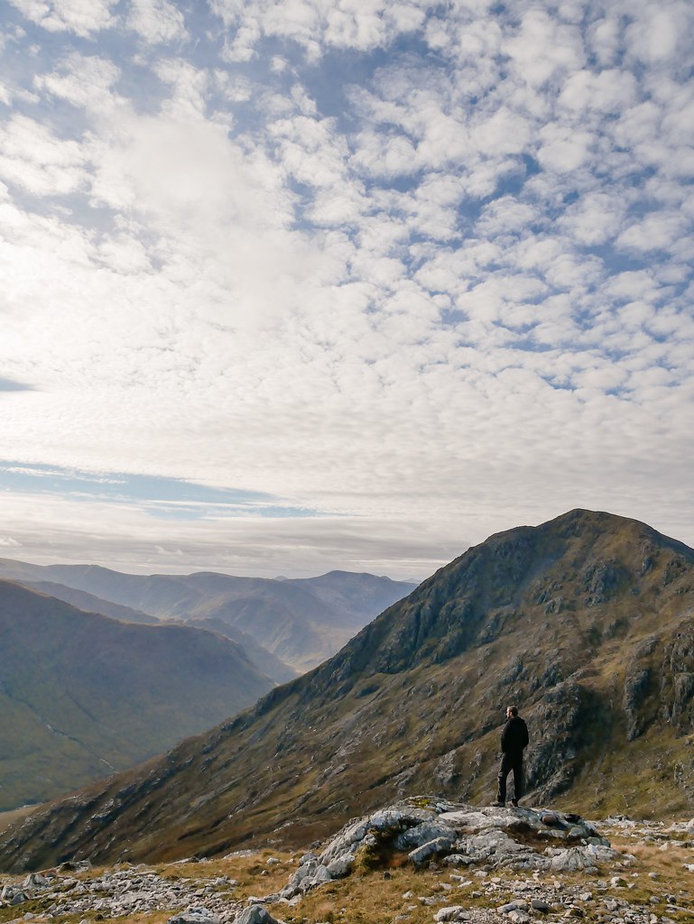
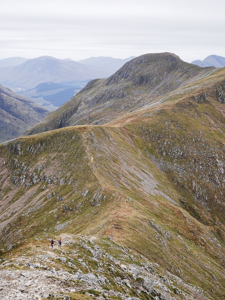
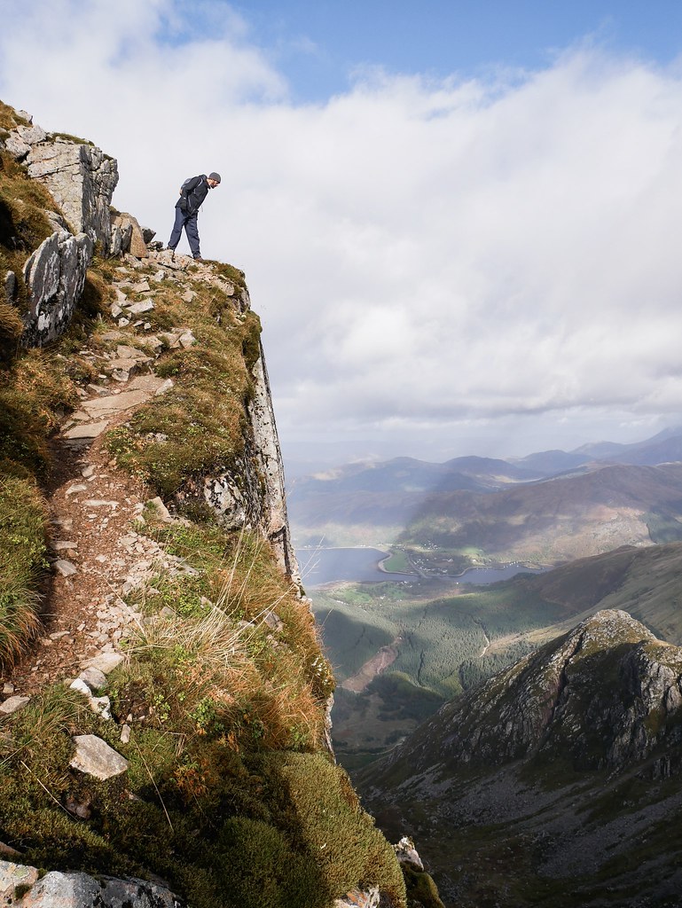
There was about a 50% chance of rain today but it was better than the previous two days so we chanced the hike. We had a steady incline up a ridge and somehow we had the sun hitting our faces. With every step we took the views improved and we had the most incredible vantage point across the mountains of Glen Coe and the sea inlets. There was so much blue sky above us but we didn’t dare acknowledge it and tempt fate so we just kept quiet and enjoyed our wee dose of vitamin D. The ridge narrowed as we made our way up the summit from which we had absolutely breathtaking views. We were surrounded by mountains, some pointy, some rounded and one even looked like a crater of a volcano which was very cool. Not only that but we could recognise all the summits we’d been on during the past week which was quite a satisfying feeling.


The wind was our only problem as it was extremely strong, making the walking conditions quite arduous. But we continued on, a layer of cloud filled the sky but the wind seem to blow it away rather quickly. The hiking route was described as exposed but we didn’t meet any difficulties and Craig was actually a little disappointed that there weren’t any ‘fun’ bits. Well we eventually ended up on the exposed section, the path headed up a ledge that was just a couple feet wide and plummeted a hundred or so meters down. The view was nice from the top, but it was more focused on the sea and lochs than the mountains so we actually preferred the first peak.


This walk was a loop and the way back was a boggy mess. We were managing to jump across sections and avoid the wettest areas but eventually there was no escaping it. We had a completely water-logged field to traverse and our only option was to take our shoes off and walk barefoot. It was much colder than I expected, and it wasn’t just water, it was a muddy and oily mess from the peat so we had to rinse our feet in a stream once we got through the worst of it. Luckily we had such great weather and views that it didn’t put a dampener on the day.


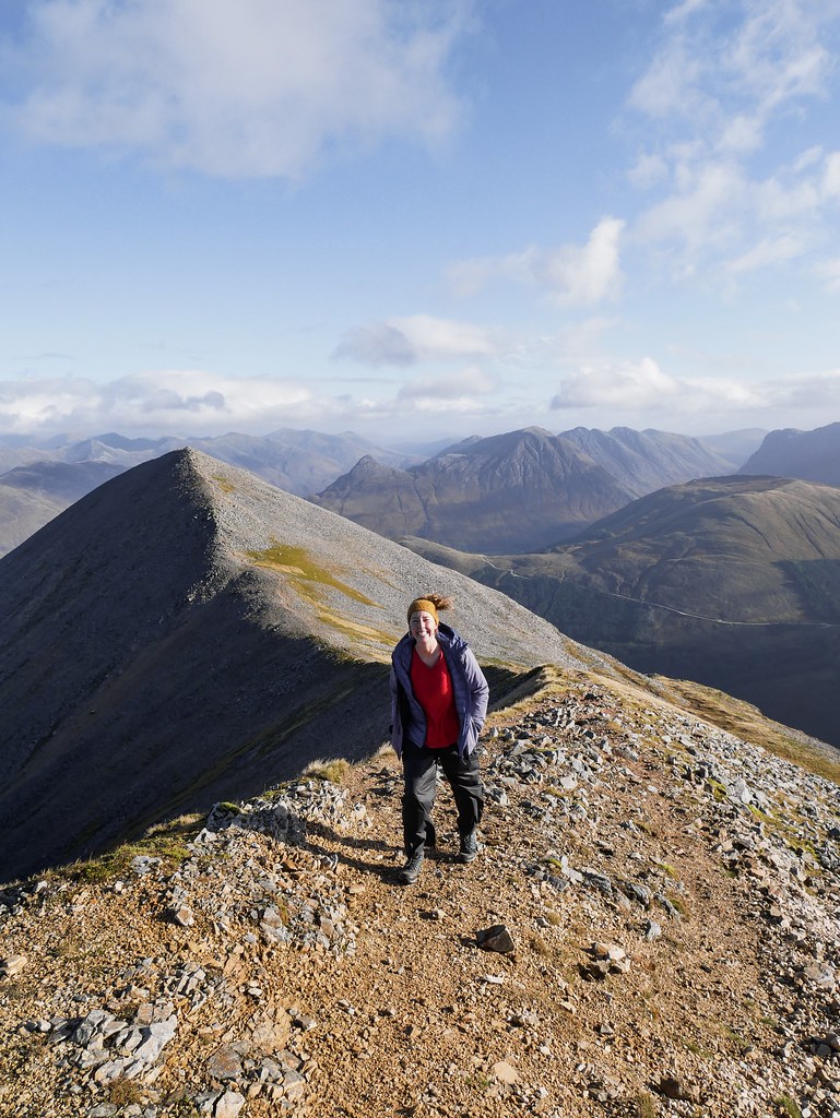
BIDEAN NAM BIAN | 11km, 7.5 hour, 1316m
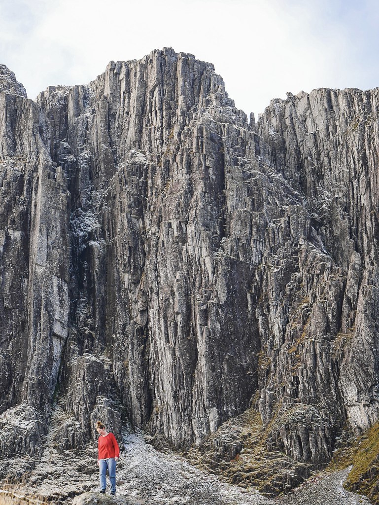
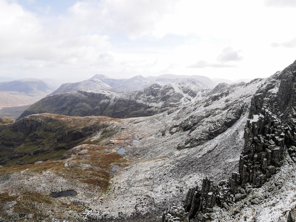
There was one more mountain we wanted to summit in Glen Coe and that was Bidean Nam Bian, said to be quite rough terrain and north facing so it holds snow on its shaded slopes for much of the year. It’s probably been snow free for a few months now, but we woke to a fresh dusting of snow on all the mountain tops. We figured it would probably melt before we got up there so we continued on with the hike. The trail led us towards a sheer, rocky wall covered in vertical cracks and crevasses.


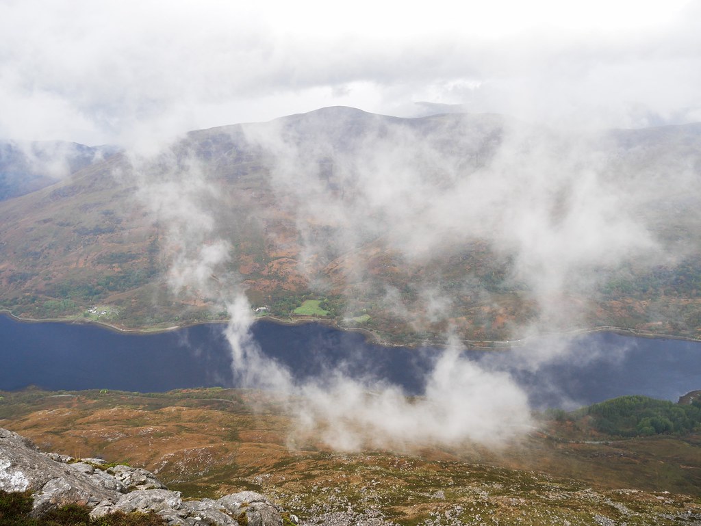
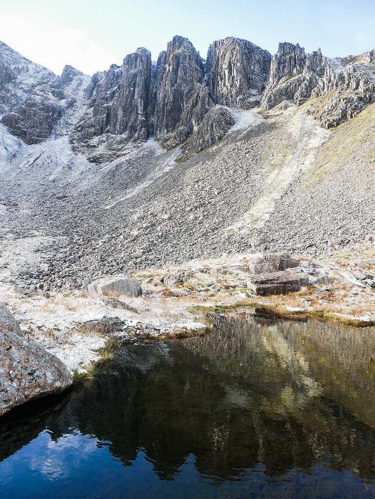
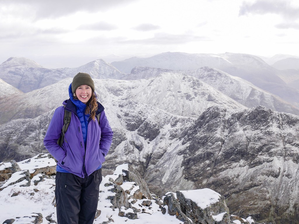
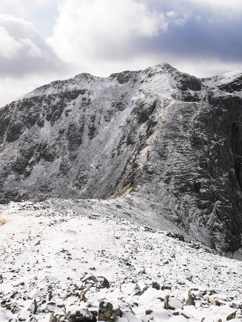
It didn’t take us long to reach the snow line so it clearly wasn’t melting any time soon and we realised it was going to be quite a challenging route. The mountain was basically made up of a pile of rocks so it was hard to tell if we were on the right track but there were three people ahead of us who’s prints we followed in the snow. They were the only other people on this hike today, so it felt quite nice and untouched. There were some sheer drops in areas but we made sure to stay away from them and take every step very carefully. We finally made it to the first of two summits and had to decide if we felt safe enough to continue. The views were breathtaking from the top, I think mountains look so much better with a layer of snow on them. We could see Ben Nevis in the distance, absolutely caked in snow.

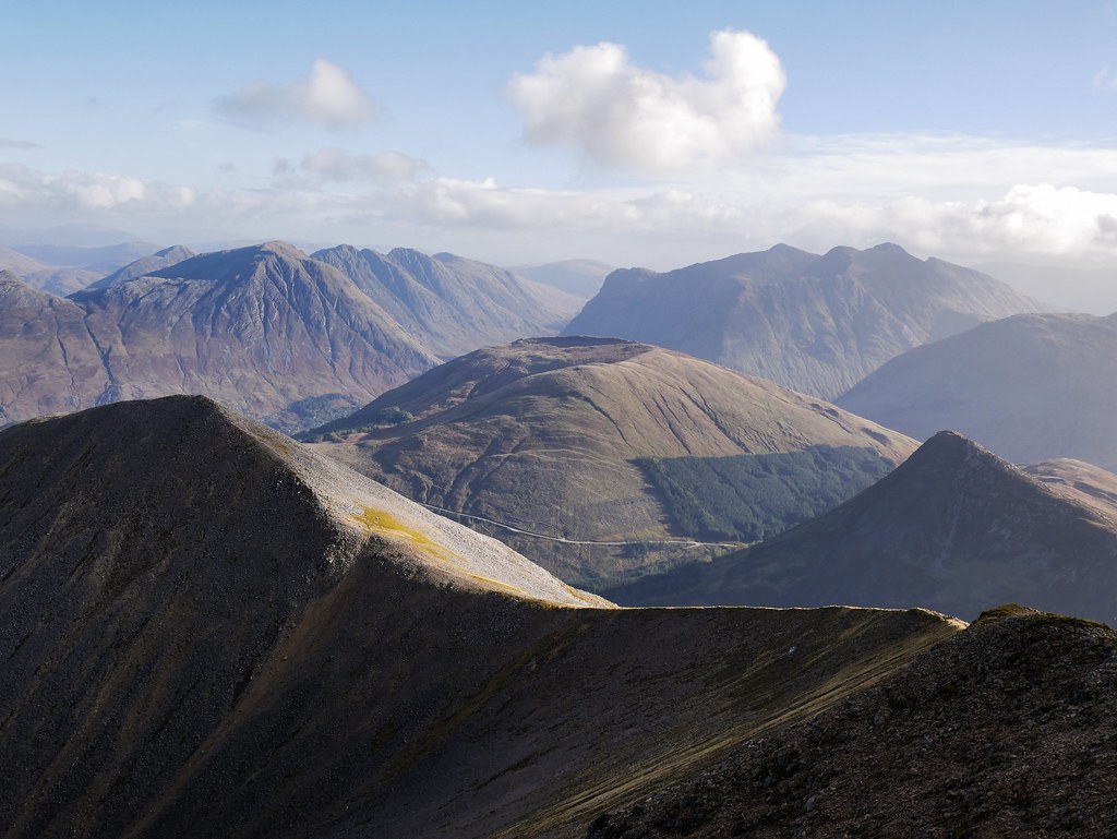
The route up the next mountain looked very steep, but then again they always seem to look worse then they are so we decided to give it a go. In fact this summit was much easier to get up as the steep path was in the sunshine and all the snow had melted which made hiking an absolute breeze. By the time we reached the top the weather had turned. Grey clouds loomed over us, with a hint of brown in them which suggested more snow was on it’s way. We had a very speedy lunch and then followed the ridge to our descent track. The route back led us through the Lost Valley where a river braided it’s way through the valley floor and led to a tangled forest of trees and mossy rocks.


Unlike the mountain hike we just did, the route to the Lost Valley is quite a popular walk, yet somehow we found it very hard to stay on the right track. We ended up getting to so many dead-ends, standing atop giant boulders with no way to get down. I don’t know how we went so wrong but after taking the most convoluted route we found a gravelly path. We overtook a family on the trail and crossed a bridge which led over a little gorge. Somehow we ended up on the wrong track again! The path just diminished and I looked at my map and realised where we’d gone wrong. We headed back to the bridge and practically opposite it was an un-missable large metal stair case. we couldn’t help but laugh, how can we be so good at navigating our way across pathless mountains yet we get lost on one of Glen Coe’s most popular trails?

We collapsed in Helga’s front seats and enjoyed a well needed cup of tea. The car park was busy with people photographing the view and a chap gave me a smile. It seemed like he was admiring Helga and it sort of looked like he wanted to talk to us or compliment our beautiful van…so I opened our little side window and said hello. As expected he said he loved our van and I said “ah thank you, her names Helga” and much to my surprise the man responded “my names Derek…nice to meet you”. I was not expecting that so I awkwardly smiled and shut the window. Derek must’ve misheard me and thought I was a total weirdo, proudly introducing myself.


BEINN A’CHRÙLAISTE | 8.5km, 3.5 hours, 652m
We were pretty much ready to leave Glen Coe but on our last day we woke to sunshine and couldn’t say no to another hike. We opted for Beinn a’Chrùlaiste which is a very nondescript hill in the valley but it offers the best view of the surrounding, jagged peaks. It was an easy assent, even though there wasn’t a path and was just boggy moorland, we were up and down in less than three hours. The views were like the hike report had suggested and we had a birds-eye view up the valley with mountains rising all around us.


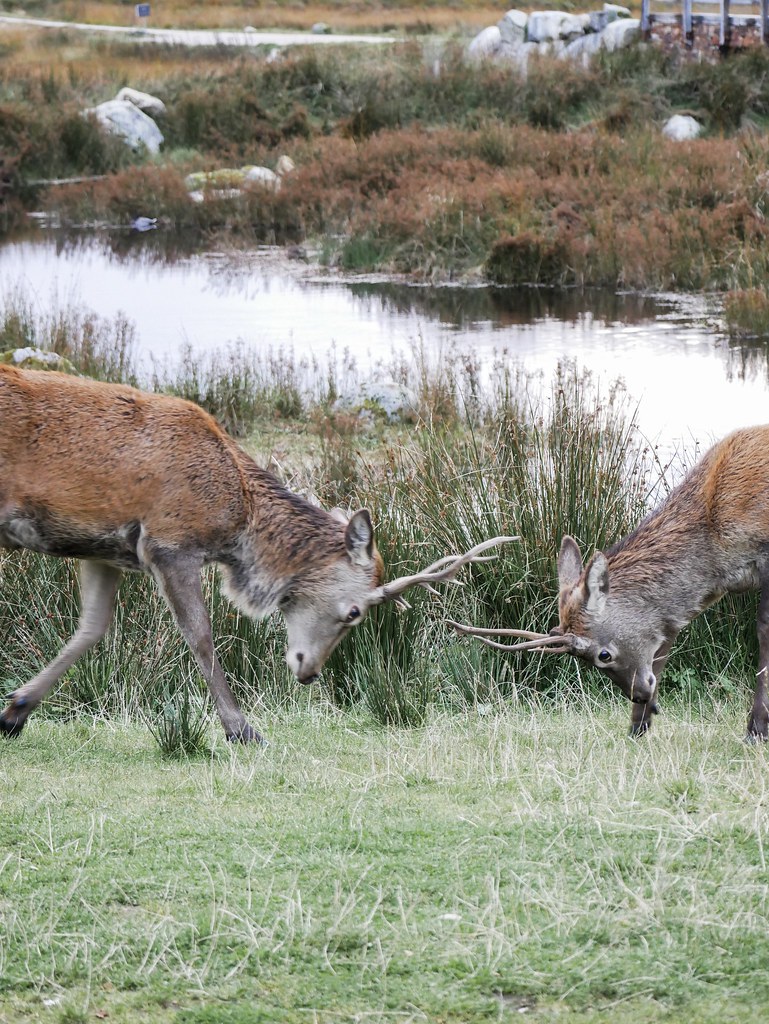
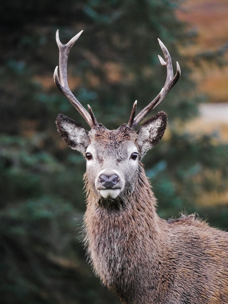
We ended up spending 10 fabulous days exploring Glen Coe and we really fell in love with the area. Along with all the hikes and incredible scenery we also witnessed the deer rut. A couple of resident stags hung out near a hotel and we were able to capture them locking antlers on a few occasions with a lovely mountain backdrop. They were only young and it looked like more of a play fight but it was still great to witness. It was the perfect end to our time in this beautiful corner of Scotland.


Beautiful photos
Thank you 😁
Oh wow, these pictures are STUNNING!
I drove through here very briefly a few years ago- I always knew that I wanted to go back, but this confirms that I should do so sooner rather than later!
Thank you 😃 It’s definitely worth heading back to, I hope you have a great time there.
Very, very beautiful pictures and – WOW! – what a hike! I habe vertigo so in some cases I would have passed (:
Thank you! It was such a beautiful area to hike, we really loved glen coe.