HELVELLYN, 950m
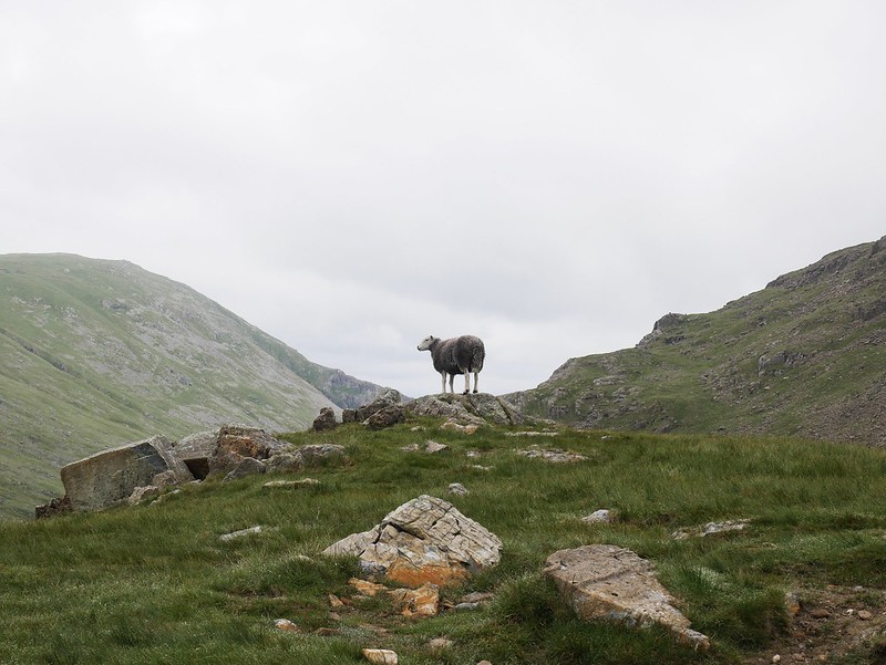
At long last the sun has returned, just for a day but heck, we were gonna make the most of it. We started with a hike up the summit of Helvellyn, which at 950m is the third highest in England. Most people approach it from Glenridding and walk the horseshoe loop around it, but we opted for a different route as we found free parking near Thrilmere reservoir….a rare thing to find in this national park. We plodded uphill for an hour or so, getting rather hot and sweaty but we didn’t stop once for a break. When we arrived at the top we walked down our first ridge of the day; Swirral Edge. It’s said to be a bit of a scramble but pretty easy compared to Striding edge, our next ridge. We were behind two guys going quite slowly, they let us go through and explained they were slow because they were from the South, to which I joyfully replied “so are we” which we all had a good giggle about.


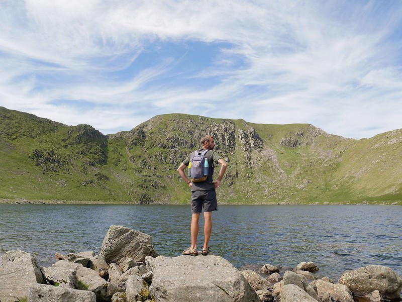
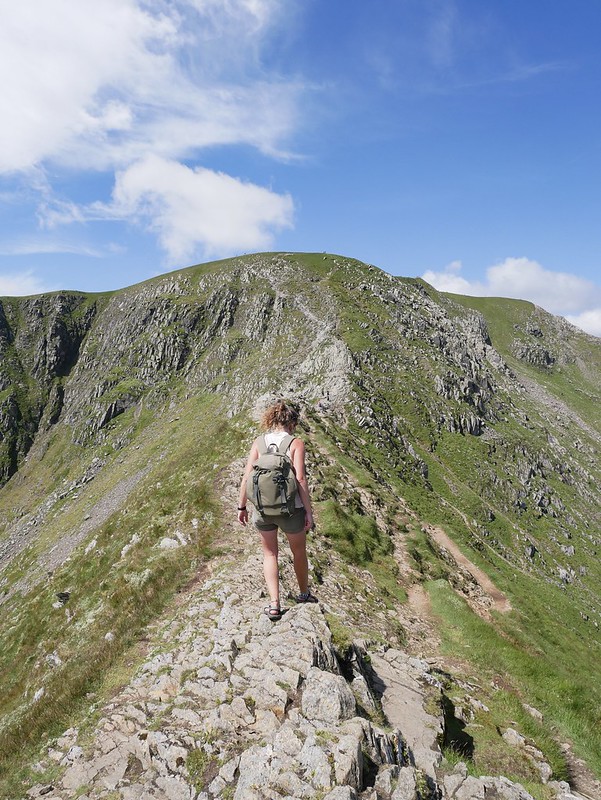
Anyway, we had a nice decline to a gorgeous little lake where we planned to go for a swim but a slightly chilly breeze put me off….Craig enjoyed a brief plunge though before we headed back uphill along the Striding Edge. We were expecting it to be like the wild ridge lines we did in snowdonia but this one was a piece of piss. 95% could be done standing up, there was only one section where we had to use our hands and leaver ourselves down a rocky ledge. There was even a narrow trail below the ridge which people hiked if they found the ridge too scary. It was a beautiful sight looking back at where we’d come from though, the ridge was jagged and looked much worse than it actually was. It’s so hard to gauge what a hike will be like, we found this ridge a little anticlimactic as it wasn’t challenging at all, whereas other people who never hike might feel like they’re walking beside a crevasse on their way up Everest.

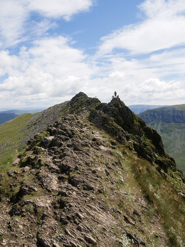

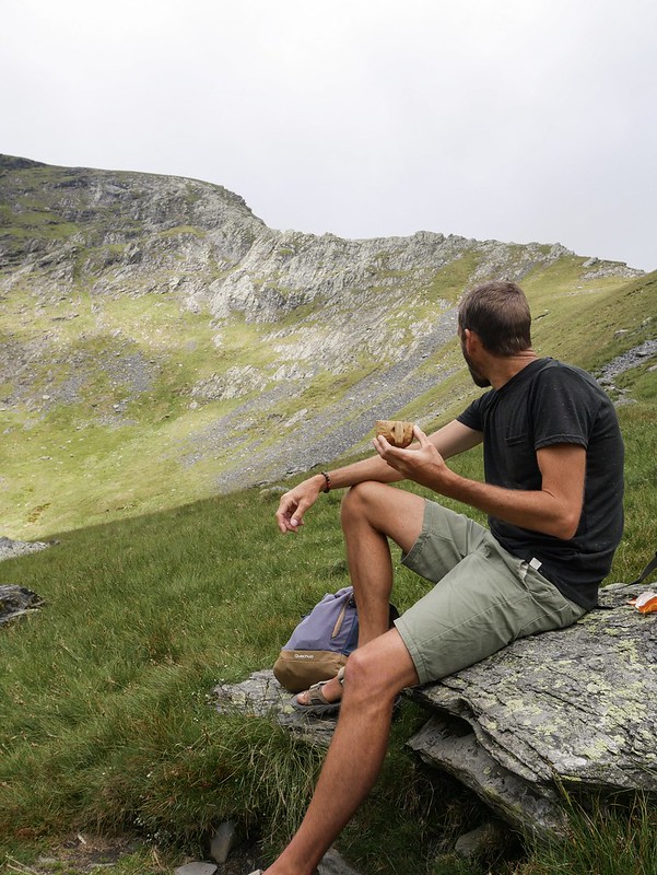
We made it to the top which was a flat plateau of a summit and stopped for some coffee. There was a memorial sign behind us for a guy who fell off the mountain and died. But it was the first sign people got to after the ridge so we found it rather amusing when people thought they were on the summit (which was just 20m away) and started taking selfies with the sign, oblivious that it was about a dead guy.


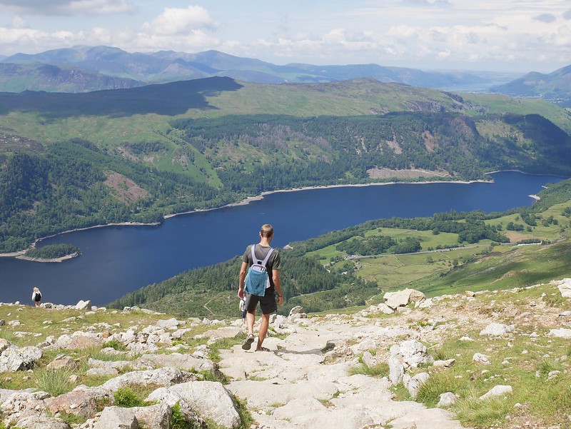
The route down was nice and fast as the footpath had wonderful little stepping slabs which made for easy walking. We veered off trail at one point for a swim in a perfect, deep pool beneath a waterfall. When we got back to Helga we had barely sat down to relax before we decided to take Roland our rowboat out onto Thirlmere reservoir. We were parked about a kilometre away from the shores so we carried the boat and pump along and got her ready on the shoreline.
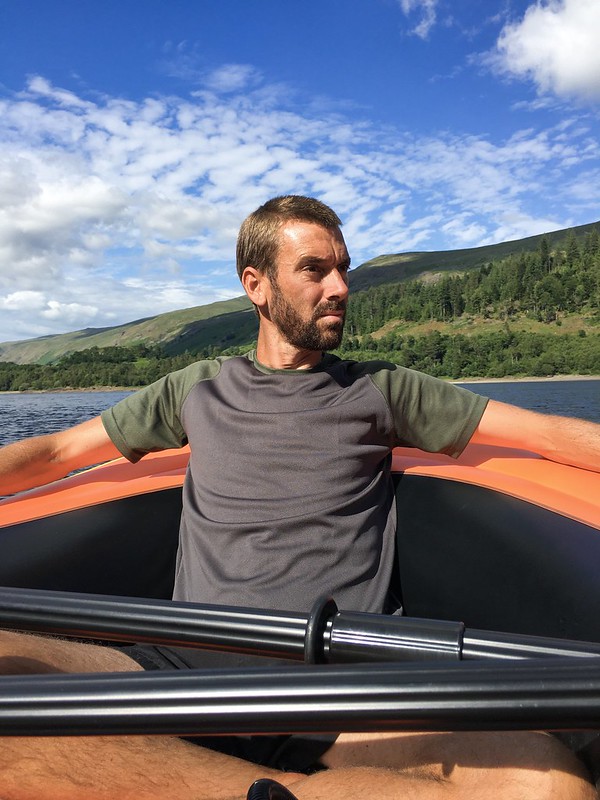
The lake was described online as “the scenery is reminiscent of the Canadian rockies” I’m sorry but no sight in the UK is reminiscent of the Rockies. For starters our lakes aren’t bright blue and glacial fed and our mountains aren’t that rocky and they don’t have glaciers clinging on them. Regardless of the ambitious claim we had a lovely paddle trip. We navigated our way around two forested islands, although one turned out to be connected to land with a gravel bar so we had to get out of Roland and do a mini portage. The wind picked up and pushed against us on our way back. It was a little challenging at times but we knew we could always paddle to shore and walk back if it became too tough. We didn’t get back to Helga until 7pm so we were pretty wiped out but boy was it a good day in the sunshine.
BLENCATHRA 868m
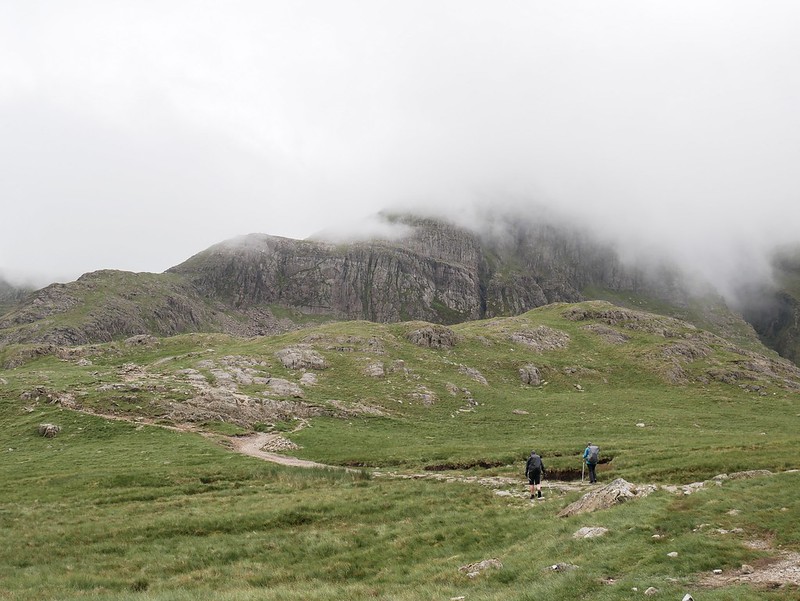
The following day wasn’t such nice weather, it was grey and gloomy with a moist air that suggested drizzle was on its way. But we decided to continue with our planned hike up Blencathra, heading up the Sharp Edge ridge and back down the Halls Fell ridge. I’d read this was one of the best ridge hikes in the Lake District. So good in fact that a few mountaineers who’ve summited the worlds highest mountains, including Everest, have voted this their favourite mountain hike. What?! I didn’t want to get my hopes up.
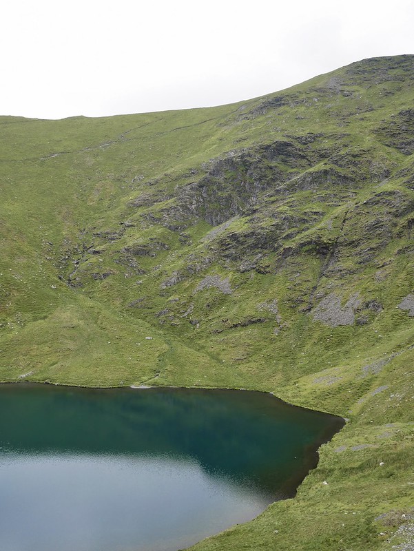
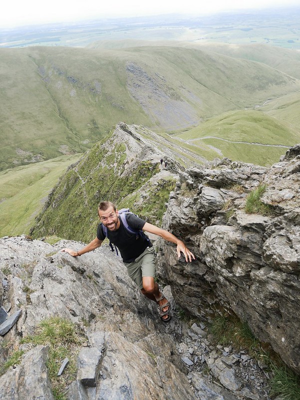
We set off from the highway and were soon heading steeply uphill. It was actually a nice gradient and before we knew it we had reached the shores of Scales Tarn. It was a tiny lake nestled in a bowl of mountains. Blencathra seemed to have numerous ridgelines branching from its summit like fingers with deep valleys between each ridge. We were heading up Sharp Edge, a notorious scramble with sheer drops and we were hoping it was a bit more of a challenge than Helvellyn.

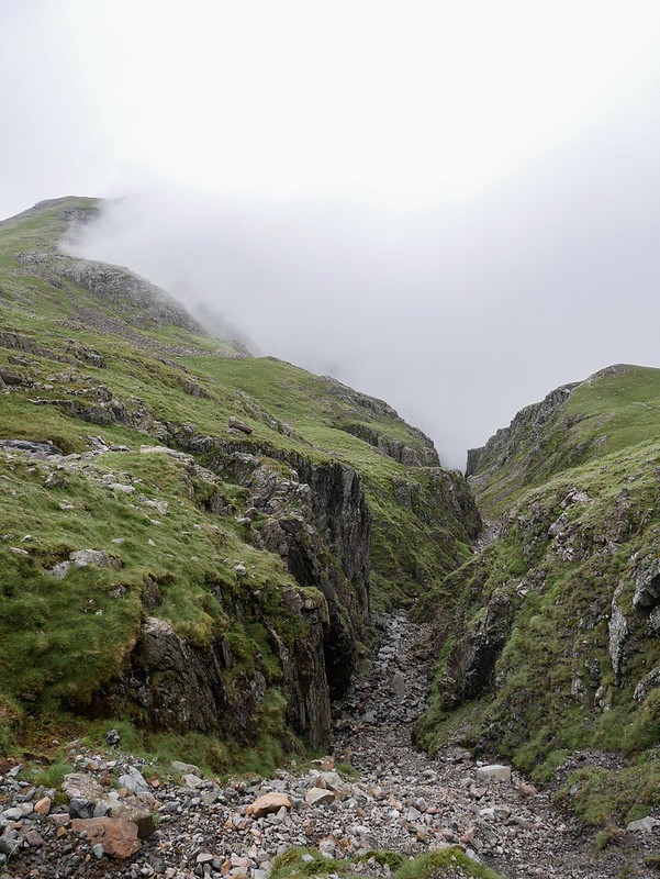
Well it started off great because we only passed 4 other hikers, a huge difference to Helvellyn which was extremely busy. The ridge was indeed a fun scramble, still not half as adrenaline inducing as the ones we did in Wales but we still really enjoyed it. One section was like a steep chasm between rock walls that we had to climb right up. It was short but sweet as we quickly made it up the ridge and onto a plateau. A short stroll along the grassy top led us to the summit where we stopped nearby for our lunch break.


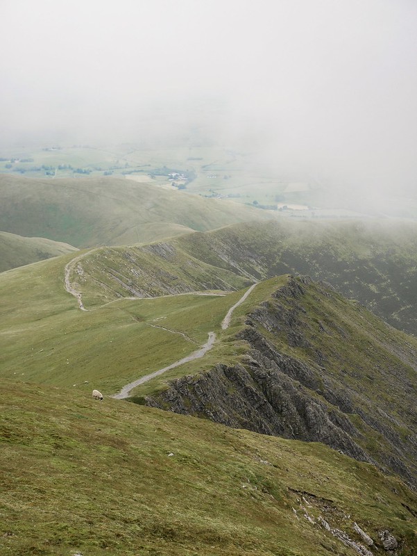
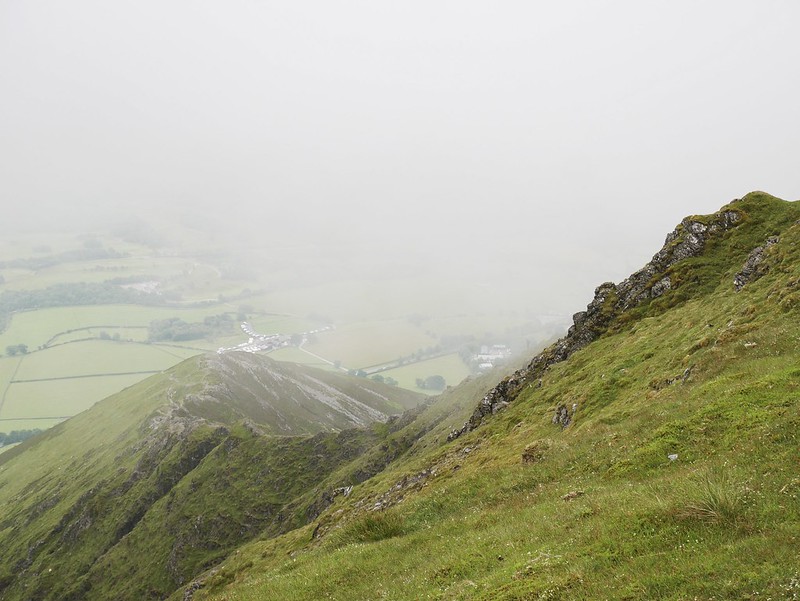
As soon as we sat down cloud swooped in. It began teasing us, drifting up the valleys and across mountain tops until we were completely engulfed in it. Our hike down the Halls Fell ridge would probably looks quite spectacular in sunny weather but it was hard to judge in the fog. The clouds were so wet and condensation was dripping from my hair and all of the rocks became very slippery. I walked along a stupid section of slanted rock which Craig warned me would be slippery and before I could get off the rock my feet were whipped away from beneath me and I slammed into the rocky wall. My thigh took the brunt of it and a huge section began to turn purple. I had blood dripping down my fingers too but luckily that was all, so annoying that I took that stupid route. We really enjoyed the hike though, especially how quiet it was.


SCAFELL PIKE 978m
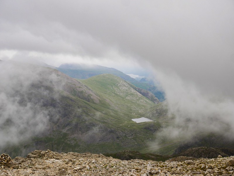
iThis is the highest mountain in England so we figured we’d best head up and see what all the fuss was about. We arrived early to guarantee a free parking space along a quiet farm road and then we set off on the Corridor Route. This is said to be the most scenic approach up to the summit. The weather was shite yet again so the views were pretty disappointing, but as we were about half way up the scenery began to improve and clouds started drifting around the mountain tops.


There was a solo male hiker who quickly overtook us, he was very fast yet he soon stopped to take photos and we overtook him. Soon enough he speed walked past us again, and then stopped for a banana. This happened about 5 times and I was starting to lose it. I told Craig that if he does it again I’m going to have to say something…god knows what but he was pissing me off and it felt like we were hiking with a third wheel.


Luckily we soon lost the twat when our lovely, peaceful path joined what felt like a bit of a highway of a trail in comparison. There were lots of people hiking this route and it was the final slog up to the summit. It’s hard to judge the impressiveness of this hike as not only was it poor weather on the way up but at the summit we were totally engulfed in a cloud. We took our first break of the hike, somehow we didn’t stop once on the three hour hike up. I think it was because we wanted to try and keep our distance from that man. So we enjoyed our picnic lunch on a rock, hoping the weather would clear but it never did. It was an eerie scene, sitting in the fog with a magpie squawking and making weird gurgling noises. The route down was a boring slog but we did find a really beautiful swimming hole beneath a river for a refreshing dip. Obviously the weather has a huge impact on the enjoyment of a hike, but England’s highest peak was a big disappointment for us and our least favourite hike in the Lake District.